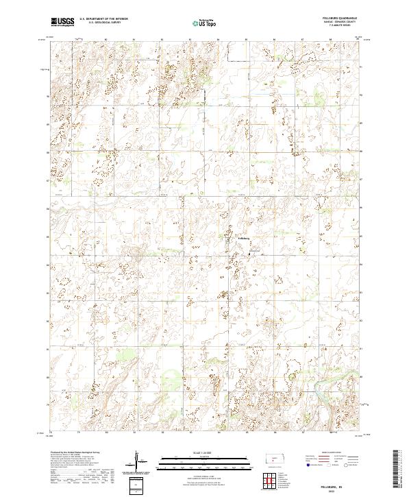
2022 Map of Fellsburg
USGS Topo · Published 2022About this map
Fellsburg serves as the central community of this agricultural landscape in Edwards County. The town is situated within a grid of section lines and county roads, reflecting the legacy of the Public Land Survey System as seen in markers like T25s R17w. On the eastern edge of the settlement, the Fellsburg Cem stands as a significant local landmark for genealogical research. The terrain is characterized by subtle drainage patterns and seasonal wetlands that eventually feed into Rattlesnake Cr in the southeast corner. This map documents the rural infrastructure of the early 21st century, where a network of thoroughfares such as Co Rd 36 and 230th Ave connect isolated farmsteads and manage the vast open spaces of the Kansas prairie.
Find a feature on this map
21 named features on this map. Tap any name to fly to it.
Don’t see what you’re looking for? This feature index may not catch every label — zoom into the map to look around manually.
Map Details
Editions of this 2022 Fellsburg Map
This is the sole edition of this map. No revisions or reprints were ever made.
Other maps of this area

1889 · Kinsley
USGS Topo · 1:125,000

1892 · Kinsley
USGS Topo · 1:125,000

1894 · Kinsley
USGS Topo · 1:125,000

1955 · Pratt
USGS Topo · 1:250,000

1959 · Pratt
USGS Topo · 1:250,000

1968 · Haviland NW
USGS Topo · 1:24,000

1968 · Haviland NE
USGS Topo · 1:24,000
1969 · Greensburg NE
USGS Topo · 1:24,000
1971 · Trousdale
USGS Topo · 1:24,000
1972 · Belpre
USGS Topo · 1:24,000