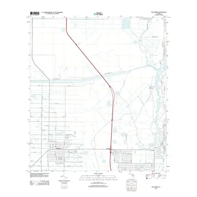
2012 Map of Fellsmere
USGS Topo · Published 2012About this map
The planned grid of Fellsmere and the nearby settlement of Brookside anchor this 2012 study of the Atlantic coastal plain. The landscape is defined by its complex water management and the winding paths of the N Prong Saint Sebastian River and S Prong Saint Sebastian River. Genealogy and local history researchers will find the Old Sebastian Cem located near the eastern edge of the survey, along with the Donald MacDonald State Camp Ground. The map reveals a transition from the urban density of the city center, marked by the Po, to the agricultural and conservation lands accessed via Fellsmere Farm Rd and the Buffer Preserve Rd. The presence of numerous numbered avenues and streets reflects the area's twentieth-century development patterns within Indian River and Brevard counties.
Find a feature on this map
84 named features on this map. Tap any name to fly to it.
Don’t see what you’re looking for? This feature index may not catch every label — zoom into the map to look around manually.
Map Details
Editions of this 2012 Fellsmere Map
This is the sole edition of this map. No revisions or reprints were ever made.
Other maps of this area

1949 · Fellsmere
USGS Topo · 1:24,000

1949 · Sebastian NW
USGS Topo · 1:24,000

1949 · Vero Beach
USGS Topo · 1:24,000

1949 · Sebastian
USGS Topo · 1:24,000

1949 · Grant
USGS Topo · 1:24,000

1950 · Vero Beach
USGS Topo · 1:24,000

1951 · Sebastian NW
USGS Topo · 1:24,000

1951 · Fellsmere
USGS Topo · 1:24,000

1951 · Grant
USGS Topo · 1:24,000

1951 · Sebastian
USGS Topo · 1:24,000