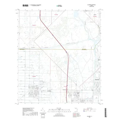
2018 Map of Fellsmere
USGS Topo · Published 2018About this map
Fellsmere and the surrounding marshlands of the Brevard Co Indian River Co line define this landscape at the edge of the Atlantic coast's inland reach. The eastern portion of the map is dominated by the winding paths of the North Prong Saint Sebastian River and the South Prong Saint Sebastian River, which converge near the historic Old Sebastian Cem and the residential expansion of Sebastian. To the west, the grid-like agricultural and residential layout of Fellsmere contrasts with the large, undeveloped tracts of the Buffer Preserve Rd area. This 2018 survey captures the intersection of established riverfront settlements and late-century residential developments like Vero Lake Estates, while the Sebastian Municipal Airport serves as a modern landmark on the eastern periphery.
Find a feature on this map
85 named features on this map. Tap any name to fly to it.
Don’t see what you’re looking for? This feature index may not catch every label — zoom into the map to look around manually.
Map Details
Editions of this 2018 Fellsmere Map
This is the sole edition of this map. No revisions or reprints were ever made.
Other maps of this area

1949 · Fellsmere
USGS Topo · 1:24,000

1949 · Sebastian NW
USGS Topo · 1:24,000

1949 · Vero Beach
USGS Topo · 1:24,000

1949 · Sebastian
USGS Topo · 1:24,000

1949 · Grant
USGS Topo · 1:24,000

1950 · Vero Beach
USGS Topo · 1:24,000

1951 · Sebastian NW
USGS Topo · 1:24,000

1951 · Fellsmere
USGS Topo · 1:24,000

1951 · Grant
USGS Topo · 1:24,000

1951 · Sebastian
USGS Topo · 1:24,000