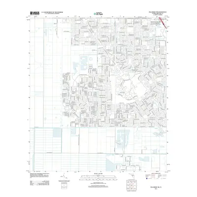
2012 Map of Fellsmere NW
USGS Topo · Published 2012About this map
The Brevard Community College- Palm Bay Campus Brevard Community College and University of Central Florida marks the northeastern corner of this area, illustrating the expansion of educational infrastructure in the southern reaches of the Space Coast. The landscape is defined by a dense grid of residential streets that transition into a more structured agricultural or water management system to the south and west. This shift is punctuated by the Melbourne Tillman Canal No 38, which serves as a significant hydrological feature for the region's drainage and land use. To the south, the suburban density gives way to larger lots and rural-style naming conventions, including Deer Run Rd and Appaloosa St, reflecting the area's mix of modern residential development and its enduring equestrian and semi-rural character.
Find a feature on this map
15 named features on this map. Tap any name to fly to it.
Don’t see what you’re looking for? This feature index may not catch every label — zoom into the map to look around manually.
Map Details
Editions of this 2012 Fellsmere NW Map
This is the sole edition of this map. No revisions or reprints were ever made.
Other maps of this area

1949 · Melbourne West
USGS Topo · 1:24,000

1949 · Fellsmere
USGS Topo · 1:24,000

1949 · Melbourne East
USGS Topo · 1:24,000

1949 · Grant
USGS Topo · 1:24,000

1951 · Melbourne East
USGS Topo · 1:24,000

1951 · Fellsmere
USGS Topo · 1:24,000

1951 · Melbourne West
USGS Topo · 1:24,000

1951 · Grant
USGS Topo · 1:24,000

1953 · Fellsmere SW
USGS Topo · 1:24,000

1953 · Fellsmere NW
USGS Topo · 1:24,000