
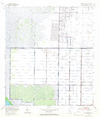
1953 Map of Fellsmere SW
USGS Topo · Published 1954About this map
St Johns Marsh dominates this mid-century landscape on the boundary of Brevard and Indian River County. The survey illustrates a period of intense hydrological modification, where an intricate network of Levee systems, Spoil Bank lines, and Floodgates work to manage the waters of the upper St. Johns River basin. In the north, several sites marked Flowing Well suggest the tapping of the artesian aquifer to support agriculture or livestock in this reclaimed terrain. The southern portion of the sheet reveals the edge of Blue Cypress Lake, a significant water body within the marsh system. Infrastructure like the Trans Florida railroad line and the Central road corridor provide the primary east-west access through this grid of engineered drainage, while a lone Silo stands as a marker of the agricultural efforts in this low-lying territory.
Find a feature on this map
10 named features on this map. Tap any name to fly to it.
Don’t see what you’re looking for? This feature index may not catch every label — zoom into the map to look around manually.
Map Details
Editions of this 1953 Fellsmere SW Map
3 editions found
Other maps of this area

1949 · Fellsmere
USGS Topo · 1:24,000

1949 · Grant
USGS Topo · 1:24,000

1951 · Fellsmere
USGS Topo · 1:24,000

1951 · Grant
USGS Topo · 1:24,000

1953 · Fellsmere NW
USGS Topo · 1:24,000

1953 · Fort Drum NE
USGS Topo · 1:24,000

1953 · Kenansville NE
USGS Topo · 1:24,000

1953 · Kenansville SE
USGS Topo · 1:24,000

1953 · Fellsmere 4 NW
USGS Topo · 1:24,000
1953 · Fellsmere 4 NE
USGS Topo · 1:24,000