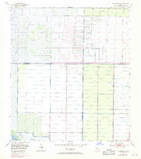
1953 Map of Fellsmere SW
USGS Topo · Published 1971About this map
St Johns Marsh dominates this landscape along the border of Brevard and Indian River counties, illustrating the extensive drainage and reclamation efforts of the mid-20th century. The intricate network of Levee and Spoil Bank systems reveals a terrain being methodically reshaped for agricultural or water management purposes. A small portion of Blue Cypress Lake is visible in the southwest corner, while the interior is dotted with features like a Silo and multiple instances of a Flowing Well, indicating active rural utility. Photorevisions from 1970 highlight changes in woodland areas and drainage, providing a clear record of how this Florida wetland environment was managed and divided into geometric sections just before the modern era of environmental conservation took hold.
Find a feature on this map
7 named features on this map. Tap any name to fly to it.
Don’t see what you’re looking for? This feature index may not catch every label — zoom into the map to look around manually.
Map Details
Editions of this 1953 Fellsmere SW Map
3 editions found
Other maps of this area

1949 · Fellsmere
USGS Topo · 1:24,000

1949 · Grant
USGS Topo · 1:24,000

1951 · Fellsmere
USGS Topo · 1:24,000

1951 · Grant
USGS Topo · 1:24,000

1953 · Fellsmere SW
USGS Topo · 1:24,000

1953 · Fellsmere NW
USGS Topo · 1:24,000

1953 · Fort Drum NE
USGS Topo · 1:24,000

1953 · Kenansville NE
USGS Topo · 1:24,000

1953 · Kenansville SE
USGS Topo · 1:24,000

1953 · Fellsmere 4 NW
USGS Topo · 1:24,000