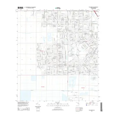
2015 Map of Fellsmere NW
USGS Topo · Published 2015About this map
The Florida-Brevard Co. line crosses this landscape, which is defined by a dense, planned street grid in the northern half and large, undeveloped tracts to the south. Malabar Rd NW and Malabar Rd NE serve as primary east-west corridors, anchoring a network of residential thoroughfares like Madison Rd NW and Missouri Rd NW. The layout reflects late-twentieth-century suburban expansion, where numerous planned roads such as Capeador St NW and Yukon St NE have been platted even in areas where development remains sparse.
Find a feature on this map
17 named features on this map. Tap any name to fly to it.
Don’t see what you’re looking for? This feature index may not catch every label — zoom into the map to look around manually.
Map Details
Editions of this 2015 Fellsmere NW Map
This is the sole edition of this map. No revisions or reprints were ever made.
Other maps of this area

1949 · Melbourne West
USGS Topo · 1:24,000

1949 · Fellsmere
USGS Topo · 1:24,000

1949 · Melbourne East
USGS Topo · 1:24,000

1949 · Grant
USGS Topo · 1:24,000

1951 · Melbourne East
USGS Topo · 1:24,000

1951 · Fellsmere
USGS Topo · 1:24,000

1951 · Melbourne West
USGS Topo · 1:24,000

1951 · Grant
USGS Topo · 1:24,000

1953 · Fellsmere SW
USGS Topo · 1:24,000

1953 · Fellsmere NW
USGS Topo · 1:24,000