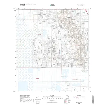
2018 Map of Fellsmere NW
USGS Topo · Published 2018About this map
Palm Bay anchors this portion of Brevard County, revealing the intricate suburban expansion into the Florida wetlands during the late 2010s. The map illustrates a landscape shaped by significant hydrological engineering, where the Melbourne Tillman Canal No 38 and the Sebastian Canal provide the necessary drainage for residential growth. These waterways contrast sharply with the preserved natural state of the Saint Johns Marsh to the west.
Find a feature on this map
23 named features on this map. Tap any name to fly to it.
Don’t see what you’re looking for? This feature index may not catch every label — zoom into the map to look around manually.
Map Details
Editions of this 2018 Fellsmere NW Map
This is the sole edition of this map. No revisions or reprints were ever made.
Other maps of this area

1949 · Melbourne West
USGS Topo · 1:24,000

1949 · Fellsmere
USGS Topo · 1:24,000

1949 · Melbourne East
USGS Topo · 1:24,000

1949 · Grant
USGS Topo · 1:24,000

1951 · Melbourne East
USGS Topo · 1:24,000

1951 · Fellsmere
USGS Topo · 1:24,000

1951 · Melbourne West
USGS Topo · 1:24,000

1951 · Grant
USGS Topo · 1:24,000

1953 · Fellsmere SW
USGS Topo · 1:24,000

1953 · Fellsmere NW
USGS Topo · 1:24,000