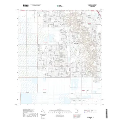
2021 Map of Fellsmere NW
USGS Topo · Published 2021About this map
Palm Bay expands into the low-lying reaches of Brevard County on this 2021 survey, where residential developments meet the expansive wetlands of the Florida interior. The eastern half of the map is dominated by a dense grid of suburban streets and educational landmarks like the University of Central Florida Palm Bay. This urbanization transitions abruptly into the Three Forks Marsh Conservation Area Trl to the west, a protected wilderness area that preserves the natural hydrology of the Saint Johns Marsh. The landscape is defined by extensive water management systems essential to the region's development, including the Melbourne Tillman Canal No 38 and the Sebastian Canal. These engineered waterways dictate the boundaries of growth, carving straight lines through the marshland to facilitate drainage and land use for the surrounding residential sectors and transit corridors like Malabar Rd NW.
Find a feature on this map
22 named features on this map. Tap any name to fly to it.
Don’t see what you’re looking for? This feature index may not catch every label — zoom into the map to look around manually.
Map Details
Editions of this 2021 Fellsmere NW Map
This is the sole edition of this map. No revisions or reprints were ever made.
Other maps of this area

1949 · Melbourne West
USGS Topo · 1:24,000

1949 · Fellsmere
USGS Topo · 1:24,000

1949 · Melbourne East
USGS Topo · 1:24,000

1949 · Grant
USGS Topo · 1:24,000

1951 · Melbourne East
USGS Topo · 1:24,000

1951 · Fellsmere
USGS Topo · 1:24,000

1951 · Melbourne West
USGS Topo · 1:24,000

1951 · Grant
USGS Topo · 1:24,000

1953 · Fellsmere SW
USGS Topo · 1:24,000

1953 · Fellsmere NW
USGS Topo · 1:24,000