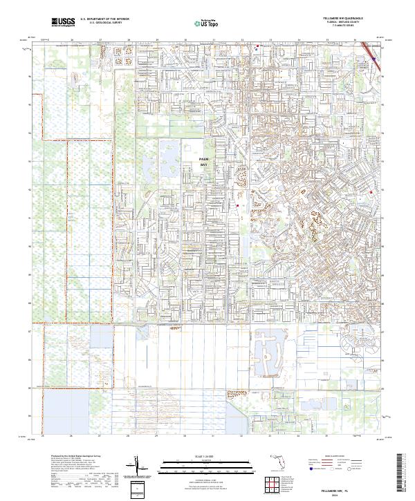
2024 Map of Fellsmere NW
USGS Topo · Published 2024About this map
Palm Bay residential expansion dominates the eastern half of this landscape, where a dense grid of suburban streets meets the preserved wetlands of the Florida interior. The transition from built environments to nature is sharp, defined by the Three Forks Marsh Conservation Area and the vast Saint Johns Marsh to the west. This intersection of human planning and hydrologic management is further evidenced by significant civil engineering projects like the Melbourne Tillman Canal No 38 and the Sebastian Canal, which serve to regulate the low-lying terrain. Education and infrastructure are key anchors here, with the University of Central Florida Palm Bay campus situated near the Interstate 95 corridor. For those interested in the recreational use of the marshlands, the Three Forks Marsh Conservation Area Trl provides a documented route through the protected wetlands.
Find a feature on this map
21 named features on this map. Tap any name to fly to it.
Don’t see what you’re looking for? This feature index may not catch every label — zoom into the map to look around manually.
Map Details
Editions of this 2024 Fellsmere NW Map
This is the sole edition of this map. No revisions or reprints were ever made.
Other maps of this area

1949 · Melbourne West
USGS Topo · 1:24,000

1949 · Fellsmere
USGS Topo · 1:24,000

1949 · Melbourne East
USGS Topo · 1:24,000

1949 · Grant
USGS Topo · 1:24,000

1951 · Melbourne East
USGS Topo · 1:24,000

1951 · Fellsmere
USGS Topo · 1:24,000

1951 · Melbourne West
USGS Topo · 1:24,000

1951 · Grant
USGS Topo · 1:24,000

1953 · Fellsmere SW
USGS Topo · 1:24,000

1953 · Fellsmere NW
USGS Topo · 1:24,000