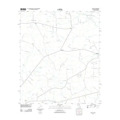
2012 Map of Felps
USGS Topo · Published 2012About this map
The community of Woodland sits at the center of this rural landscape in East Feliciana Parish, where the local economy is defined by a network of creeks and bayous. In the early 21st century, these waterways, including Woodland Cr and Sandy Cr, remain central to the geography of small settlements like Felixville, Felps, and Teddy. Genealogy and local history are preserved in family-named sites such as Kent Cem, Gerald Cem, and Doughty Cem, which are scattered among the timbered parcels and fields. Transport and navigation are represented by the Clinton Lookout Tower, while smaller aviation facilities like Freeman Landing Strip and Littlefield Airport provide air access to this quiet interior. The presence of Camp Atakapa and Camp Avondale suggests a landscape utilized for organized recreation and forestry, connected by a dense lattice of local routes such as Mallie Jefferson Rd and Dan Delee Rd.
Find a feature on this map
85 named features on this map. Tap any name to fly to it.
Don’t see what you’re looking for? This feature index may not catch every label — zoom into the map to look around manually.
Map Details
Editions of this 2012 Felps Map
This is the sole edition of this map. No revisions or reprints were ever made.
Other maps of this area

1906 · Bayou Sara
USGS Topo · 1:125,000

1941 · Woodland
USGS Topo · 1:31,680

1941 · Norwood
USGS Topo · 1:31,680

1941 · Gilead
USGS Topo · 1:31,680

1941 · Chipola
USGS Topo · 1:31,680

1942 · Gilead
USGS Topo · 1:31,680

1945 · Norwood
USGS Topo · 1:31,680

1945 · Chipola
USGS Topo · 1:31,680

1946 · Clinton
USGS Topo · 1:31,680

1949 · Bluff Creek
USGS Topo · 1:31,680