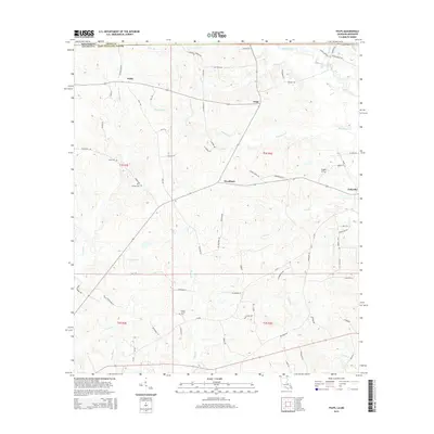
2015 Map of Felps
USGS Topo · Published 2015About this map
Woodland and Felixville anchor the eastern side of this landscape in East Feliciana Parish, where the rolling terrain is defined by a dense network of winding creeks and bayous. In the north, Teddy and Felps mark small centers of activity connected by rural routes such as Perkins Rd and Dan Delee Rd. The land is heavily partitioned by family-named landmarks and historical burial grounds, including the Beech Grove Cem, Kent Cem, and Doughty Cem, which offer significant data for genealogical research.
Find a feature on this map
77 named features on this map. Tap any name to fly to it.
Don’t see what you’re looking for? This feature index may not catch every label — zoom into the map to look around manually.
Map Details
Editions of this 2015 Felps Map
This is the sole edition of this map. No revisions or reprints were ever made.
Other maps of this area

1906 · Bayou Sara
USGS Topo · 1:125,000

1941 · Woodland
USGS Topo · 1:31,680

1941 · Norwood
USGS Topo · 1:31,680

1941 · Gilead
USGS Topo · 1:31,680

1941 · Chipola
USGS Topo · 1:31,680

1942 · Gilead
USGS Topo · 1:31,680

1945 · Norwood
USGS Topo · 1:31,680

1945 · Chipola
USGS Topo · 1:31,680

1946 · Clinton
USGS Topo · 1:31,680

1949 · Bluff Creek
USGS Topo · 1:31,680