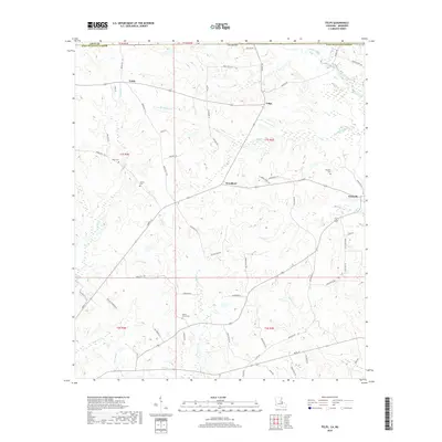
2018 Map of Felps
USGS Topo · Published 2018About this map
Poverty Bayou and Stone Bayou wind through the southwestern corner of this landscape, marking the transition from the low-lying drainage basins of Louisiana toward the higher ground near the Mississippi state line. The settlement pattern is characterized by small, dispersed rural communities like Woodland, Felixville, and Felps, which are connected by a network of local roads such as Parish Rd 7-110 and Liberty St. For local historians and genealogists, the map identifies several family-named burial grounds, including Kent Cem, Gerald Cem, and Doughty Cem, which are often the only remaining physical markers of nineteenth-century farmsteads. The topography is defined by numerous small waterways, including Beaver Creek and Sandy Cr, that feed into larger regional systems. This 2018 update captures the enduring rural character of East Feliciana Parish, where the land remains largely devoted to timber and agriculture rather than suburban expansion.
Find a feature on this map
77 named features on this map. Tap any name to fly to it.
Don’t see what you’re looking for? This feature index may not catch every label — zoom into the map to look around manually.
Map Details
Editions of this 2018 Felps Map
This is the sole edition of this map. No revisions or reprints were ever made.
Other maps of this area

1906 · Bayou Sara
USGS Topo · 1:125,000

1941 · Woodland
USGS Topo · 1:31,680

1941 · Norwood
USGS Topo · 1:31,680

1941 · Gilead
USGS Topo · 1:31,680

1941 · Chipola
USGS Topo · 1:31,680

1942 · Gilead
USGS Topo · 1:31,680

1945 · Norwood
USGS Topo · 1:31,680

1945 · Chipola
USGS Topo · 1:31,680

1946 · Clinton
USGS Topo · 1:31,680

1949 · Bluff Creek
USGS Topo · 1:31,680