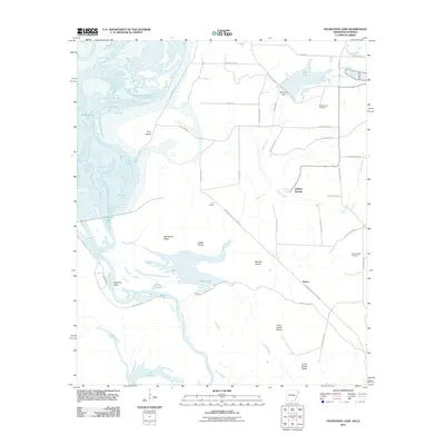
2011 Map of Felsenthal Dam
USGS Topo · Published 2011About this map
The Ouachita River meanders through a complex landscape of backwater lakes and alluvial ridges in this southern Arkansas river valley. This environment is characterized by large, interconnected water bodies such as Redeye Lake, Mossy Lake, and Cooley Lake, which dominate the western half of the territory. The topography reflects a history of shifting water levels and sediment deposition, evidenced by features like Pine Island and the elevated Big Mound Ridge.
Find a feature on this map
44 named features on this map. Tap any name to fly to it.
Don’t see what you’re looking for? This feature index may not catch every label — zoom into the map to look around manually.
Map Details
Editions of this 2011 Felsenthal Dam Map
This is the sole edition of this map. No revisions or reprints were ever made.
Other maps of this area

1934 · Felsenthal
USGS Topo · 1:62,500

1935 · Naff
USGS Topo · 1:62,500

1935 · Haile
USGS Topo · 1:62,500

1937 · Felsenthal
USGS Topo · 1:62,500

1938 · Felsenthal
USGS Topo · 1:62,500

1939 · Felsenthal
USGS Topo · 1:62,500

1953 · Greenwood
USGS Topo · 1:250,000

1953 · El Dorado
USGS Topo · 1:250,000

1955 · Jackson
USGS Topo · 1:250,000

1955 · Shreveport
USGS Topo · 1:250,000