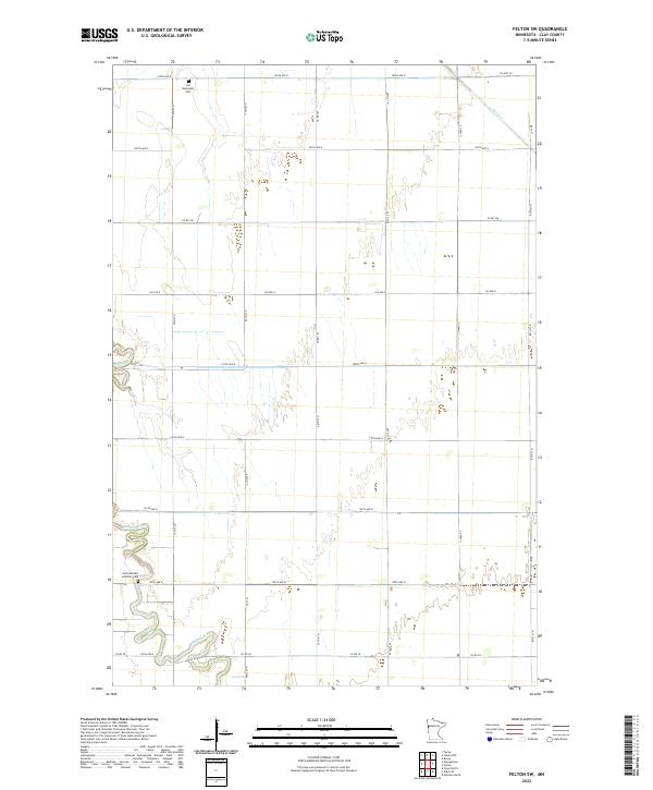
2022 Map of Felton SW
USGS Topo · Published 2022About this map
The meandering Buffalo River snakes across this corner of Clay County, defining a landscape marked by deep-rooted prairie settlements and a precise grid of agricultural transit. This survey of the Felton SW area documents a rural community centered around its local landmarks, most notably the Old Methodist Cem and the North Buffalo Lutheran Cem, which serve as quiet anchors for the surrounding township sections. The transition from the river's sinuous path to the straight lines of the rural road network, including the vital Co Rd 28 and Co Hwy 38, illustrates the intersection of natural drainage and modern land management. Further north, the flow of Felton Cr cuts through the northeastern reaches, providing a secondary water source for the homesteads that define this fertile Minnesota region.
Find a feature on this map
20 named features on this map. Tap any name to fly to it.
Don’t see what you’re looking for? This feature index may not catch every label — zoom into the map to look around manually.
Map Details
Editions of this 2022 Felton SW Map
This is the sole edition of this map. No revisions or reprints were ever made.
Other maps of this area

1895 · Fargo
USGS Topo · 1:125,000

1897 · Fargo
USGS Topo · 1:125,000

1952 · Grand Forks
USGS Topo · 1:250,000

1953 · Fargo
USGS Topo · 1:250,000

1956 · Fargo
USGS Topo · 1:250,000

1956 · Grand Forks
USGS Topo · 1:250,000

1959 · Fargo North
USGS Topo · 1:24,000

1963 · Georgetown
USGS Topo · 1:24,000

1963 · Perley
USGS Topo · 1:24,000

1964 · Dilworth
USGS Topo · 1:24,000