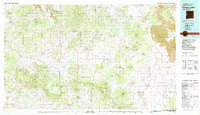
1981 Map of Fence Lake
USGS Topo · Published 1981About this map
Candy Kitchen and Fence Lake anchor this western New Mexico landscape, which transitions from the high Zuni Indian Reservation down to the open expanse of the North Plains. The terrain is defined by a series of volcanic features and prominent mesas, including Mesa de Yeso and the extensive lava flows of The Malpais. Cultural history is traced through the Old Zuni Trail, which cuts across a complex drainage system featuring Jaralosa Draw and Pinitos Draw. Significant land management boundaries are visible where the Ramah Indian Area meets the Cibola National Forest. Small outposts like Las Norias Store and Techado provide evidence of isolated settlement patterns in this arid region, where water sources like Ojo Caliente Spring were historically vital for transit and livestock.
Find a feature on this map
74 named features on this map. Tap any name to fly to it.
Don’t see what you’re looking for? This feature index may not catch every label — zoom into the map to look around manually.
Map Details
Editions of this 1981 Fence Lake Map
2 editions found
Other maps of this area

1883 · Mt. Taylor
USGS Topo · 1:250,000

1886 · St Johns
USGS Topo · 1:250,000

1886 · Wingate
USGS Topo · 1:250,000

1886 · Mt. Taylor
USGS Topo · 1:250,000

1886 · Fort Defiance
USGS Topo · 1:250,000

1892 · Fort Defiance
USGS Topo · 1:250,000

1892 · St Johns
USGS Topo · 1:250,000

1892 · Wingate
USGS Topo · 1:250,000

1892 · Mt. Taylor
USGS Topo · 1:250,000

1899 · Mt. Taylor
USGS Topo · 1:250,000
Featured Places
- Eastern Navajo Agency, NM
- Atarque, NM
- Grassie Place, NM
- Ojo Caliente, NM
- Pinehill, Eastern Navajo Agency