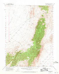
1961 Map of Fencemaker
USGS Topo · Published 1971About this map
Fencemaker Camp and the small settlement of Bowen sit at the desert crossroads of the northern Nevada interior, as recorded in this 1961 field survey. The landscape is dominated by the north-south axis of the Fencemaker Range and the Stillwater Range, where high points like Logan Peak overlook the arid floor of the Buena Vista Valley. Life in this basin-and-range terrain was dictated by the availability of water, marked by a network of scattered points such as Polkinghorne Spring, Grayson Spring, and the Buena Vista Windmill. Evidence of the region’s economic activity is visible through the presence of Gilberts Mine and unnamed mines near Kitten Springs. Notable infrastructure from this period includes a Communication Facility and Radio Facility located near Fencemaker Pass, reflecting the mid-century integration of telecommunications into this high-desert environment along the Pershing and Churchill County line.
Find a feature on this map
41 named features on this map. Tap any name to fly to it.
Don’t see what you’re looking for? This feature index may not catch every label — zoom into the map to look around manually.
Map Details
Editions of this 1961 Fencemaker Map
3 editions found

Other maps of this area

1908 · Carson Sink
USGS Topo · 1:250,000

1910 · Carson Sink
USGS Topo · 1:250,000

1931 · Lovelock
USGS Topo · 1:250,000

1932 · Sonoma Range
USGS Topo · 1:250,000

1935 · Lovelock
USGS Topo · 1:250,000

1939 · Sonoma Range
USGS Topo · 1:250,000

1954 · Unionville
USGS Topo · 1:62,500

1954 · Buffalo Mtn
USGS Topo · 1:62,500

1955 · Millett
USGS Topo · 1:250,000

1955 · Lovelock
USGS Topo · 1:250,000