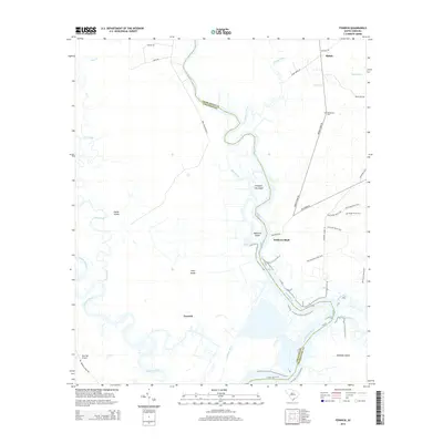
2014 Map of Fenwick
USGS Topo · Published 2014About this map
The Edisto River carves a winding path through the Lowcountry on this map, defining the boundary between Charleston and Colleton counties. Along its banks, Willtown Bluff stands as a notable point of interest, overlooking the marshy expanse where the river system branches into the South Edisto River and Dauho River. The landscape is a complex network of waterways and islands, including Prospect Hill Island, Pine Island, and the large Jehossee Island to the southeast. Inland, the settlement of Fenwick and the crossroads at Shiloh anchor the local geography. Traces of historical transport and land use are evident in the Old Railroad Loop Trail and various named plantation lanes like Hope Plantation Ln. The map also identifies the Bethlehem Cem and the Airy Hall Airport near the Ashepoo River, highlighting the blend of traditional rural landmarks and modern infrastructure.
Find a feature on this map
40 named features on this map. Tap any name to fly to it.
Don’t see what you’re looking for? This feature index may not catch every label — zoom into the map to look around manually.
Map Details
Editions of this 2014 Fenwick Map
This is the sole edition of this map. No revisions or reprints were ever made.
Other maps of this area

1918 · Walterboro
USGS Topo · 1:62,500

1918 · Green Pond
USGS Topo · 1:62,500

1918 · Cottageville
USGS Topo · 1:62,500

1919 · Edisto Island
USGS Topo · 1:62,500

1943 · Cottageville
USGS Topo · 1:62,500

1943 · Edisto Island
USGS Topo · 1:62,500

1943 · Green Pond
USGS Topo · 1:62,500

1943 · Walterboro
USGS Topo · 1:62,500

1947 · Savannah
USGS Topo · 1:250,000

1948 · Savannah
USGS Topo · 1:250,000