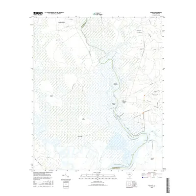
2017 Map of Fenwick
USGS Topo · Published 2017About this map
Snuggedy Swamp dominates the low-lying coastal landscape at the meeting point of the Ashepoo River and the South Edisto River along the border of Colleton and Charleston counties. This 2017 survey details a region defined by its tidal waterways and historic land divisions, where large tracts are named as islands despite being part of a larger marsh complex, including Cattle Island, Pine Island, and Prospect Hill Island. The settlement at Fenwick sits at the heart of this wetland system, while the northern reaches show more established upland development near Jacksonboro and Adams Run.
Find a feature on this map
41 named features on this map. Tap any name to fly to it.
Don’t see what you’re looking for? This feature index may not catch every label — zoom into the map to look around manually.
Map Details
Editions of this 2017 Fenwick Map
This is the sole edition of this map. No revisions or reprints were ever made.
Other maps of this area

1918 · Walterboro
USGS Topo · 1:62,500

1918 · Green Pond
USGS Topo · 1:62,500

1918 · Cottageville
USGS Topo · 1:62,500

1919 · Edisto Island
USGS Topo · 1:62,500

1943 · Cottageville
USGS Topo · 1:62,500

1943 · Edisto Island
USGS Topo · 1:62,500

1943 · Green Pond
USGS Topo · 1:62,500

1943 · Walterboro
USGS Topo · 1:62,500

1947 · Savannah
USGS Topo · 1:250,000

1948 · Savannah
USGS Topo · 1:250,000