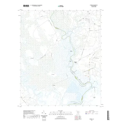
2020 Map of Fenwick
USGS Topo · Published 2020About this map
Snuggedy Swamp and a network of river-fed marshes define this coastal Lowcountry landscape where the Ashepoo River and Edisto River meet. The map reveals a land structured by water and historical land divisions, including large tracts like Cattle Island and Pine Island. The settlement of Fenwick sits centrally amidst the wetlands, while the historical riverside site at Willtown Bluff overlooks the bending Edisto.
Find a feature on this map
40 named features on this map. Tap any name to fly to it.
Don’t see what you’re looking for? This feature index may not catch every label — zoom into the map to look around manually.
Map Details
Editions of this 2020 Fenwick Map
This is the sole edition of this map. No revisions or reprints were ever made.
Other maps of this area

1918 · Walterboro
USGS Topo · 1:62,500

1918 · Green Pond
USGS Topo · 1:62,500

1918 · Cottageville
USGS Topo · 1:62,500

1919 · Edisto Island
USGS Topo · 1:62,500

1943 · Cottageville
USGS Topo · 1:62,500

1943 · Edisto Island
USGS Topo · 1:62,500

1943 · Green Pond
USGS Topo · 1:62,500

1943 · Walterboro
USGS Topo · 1:62,500

1947 · Savannah
USGS Topo · 1:250,000

1948 · Savannah
USGS Topo · 1:250,000