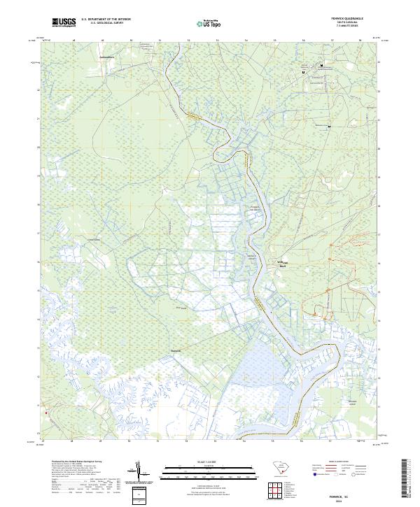
2024 Map of Fenwick
USGS Topo · Published 2024About this map
The Edisto River winds through this low-lying coastal plain, serving as the primary geographic corridor through a landscape defined by expansive wetlands and deltaic waterways. Small settlements such as Jacksonboro and Adams Run sit along the northern reaches of the quadrangle, connected by historical road alignments that trace the higher ground between the swampy interior and the riverbanks. To the south, the namesake community of Fenwick is positioned near the tidal reaches where the river system begins its final approach to the Atlantic. This 2024 survey captures the persistent rural character of the South Carolina Lowcountry, documenting the modern distribution of family-named road networks and the enduring footprint of coastal hamlets that have anchored this region for generations.
Find a feature on this map
4 named features on this map. Tap any name to fly to it.
Don’t see what you’re looking for? This feature index may not catch every label — zoom into the map to look around manually.
Map Details
Editions of this 2024 Fenwick Map
This is the sole edition of this map. No revisions or reprints were ever made.
Other maps of this area

1918 · Walterboro
USGS Topo · 1:62,500

1918 · Green Pond
USGS Topo · 1:62,500

1918 · Cottageville
USGS Topo · 1:62,500

1919 · Edisto Island
USGS Topo · 1:62,500

1943 · Cottageville
USGS Topo · 1:62,500

1943 · Edisto Island
USGS Topo · 1:62,500

1943 · Green Pond
USGS Topo · 1:62,500

1943 · Walterboro
USGS Topo · 1:62,500

1947 · Savannah
USGS Topo · 1:250,000

1948 · Savannah
USGS Topo · 1:250,000