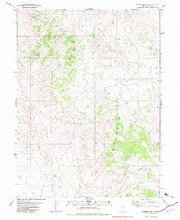
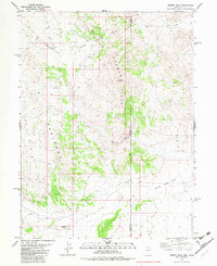
1982 Map of Ferber Peak NW
USGS Topo · Published 1982About this map
Badlands formations dominate the southeastern portion of this terrain in Elko County, Nevada, reflecting the arid and highly weathered character of the Great Basin during the early 1980s. The landscape is defined by a network of seasonal drainage patterns and a sparse infrastructure primarily supporting livestock and communication. A Radio Tower sits atop a prominent elevation in the northwest, while scattered livestock management points are marked by a Corral in the northeast and another in the southwest. Movement through the area is largely restricted to a primitive Jeep Trail system, indicating the minimal development and emphasis on land management and ranching typical of this high-desert region.
Find a feature on this map
4 named features on this map. Tap any name to fly to it.
Don’t see what you’re looking for? This feature index may not catch every label — zoom into the map to look around manually.
Map Details
Editions of this 1982 Ferber Peak NW Map
2 editions found
Other maps of this area

1955 · Elko
USGS Topo · 1:250,000

1958 · Elko
USGS Topo · 1:250,000

1962 · Elko
USGS Topo · 1:250,000

1965 · Elko
USGS Topo · 1:250,000

1972 · White Horse Pass
USGS Topo · 1:24,000

1972 · Utah Peak
USGS Topo · 1:24,000
1982 · Kinsley Mountains
USGS Topo · 1:24,000
1982 · Ayarbe Spring
USGS Topo · 1:24,000
1982 · Ferber Peak
USGS Topo · 1:24,000
1982 · White Horse Mountain
USGS Topo · 1:24,000