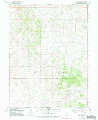
1982 Map of Ferber Peak NW
USGS Topo · Published 1992About this map
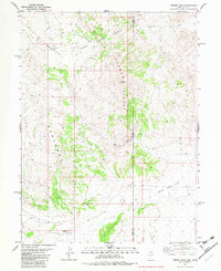
The Badlands terrain dominates this 1982 map of the Ferber Peak NW region, where the intricate network of erosional features provides a clear picture of the arid drainage patterns in eastern Elko County. This area of Nevada is defined by a landscape of high-elevation relief and seasonal watercourses, navigated primarily by 4wd routes that snake through the canyons and across the ridges. Evidence of human activity in this secluded environment is sparse, centered on small-scale ranching and utility infrastructure. A solitary Corral serves as a reminder of the region's grazing history, while a Radio Tower atop a high ridge signifies the modern necessity of communications across these expansive basins. The map captures the balance between the natural geological forces of the Great Basin and the minimal, functional imprints left by those working the land.
Find a feature on this map
4 named features on this map. Tap any name to fly to it.
Don’t see what you’re looking for? This feature index may not catch every label — zoom into the map to look around manually.
Map Details
Editions of this 1982 Ferber Peak NW Map
2 editions found
Other maps of this area

1955 · Elko
USGS Topo · 1:250,000

1958 · Elko
USGS Topo · 1:250,000

1962 · Elko
USGS Topo · 1:250,000

1965 · Elko
USGS Topo · 1:250,000

1972 · White Horse Pass
USGS Topo · 1:24,000

1972 · Utah Peak
USGS Topo · 1:24,000
1982 · Kinsley Mountains
USGS Topo · 1:24,000
1982 · Ayarbe Spring
USGS Topo · 1:24,000
1982 · Ferber Peak NW
USGS Topo · 1:24,000
1982 · Ferber Peak
USGS Topo · 1:24,000