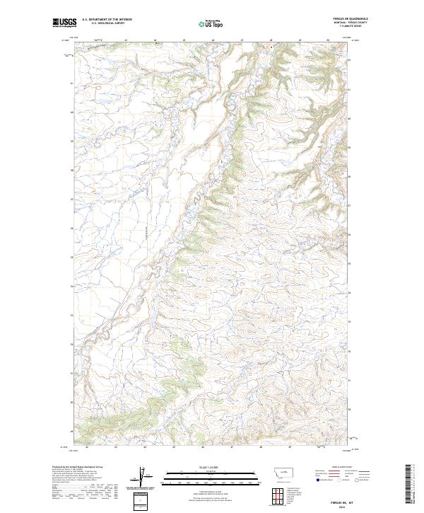
2024 Map of Fergus NE
USGS Topo · Published 2024About this map
Armells Creek and its seasonal tributaries define the drainage patterns across this section of Fergus County. The landscape is characterized by the complex branching of Cottonwood Creek and the South Fork Cottonwood Creek, which have carved deep paths through the high plains. Land use is organized by the Public Land Survey System, with the boundaries of t20n r20e and t19n r21e marking the transition between townships. The presence of features like Burnt Timber Coulee and Murphy Coulee highlights the importance of traditional water-carved landmarks in this ranching country. The network of local roads and cattle guards suggests a rural economy tied closely to the land, where the intermittent flow of Dry Armells Creek remains a critical geographic marker for those managing livestock and tracing land ownership.
Find a feature on this map
10 named features on this map. Tap any name to fly to it.
Don’t see what you’re looking for? This feature index may not catch every label — zoom into the map to look around manually.
Map Details
Editions of this 2024 Fergus NE Map
This is the sole edition of this map. No revisions or reprints were ever made.
Other maps of this area

1943 · Landusky
USGS Topo · 1:125,000

1954 · Lewistown
USGS Topo · 1:250,000

1959 · Lewistown
USGS Topo · 1:250,000

1978 · Lewistown
USGS Topo · 1:100,000

1984 · Zortman
USGS Topo · 1:100,000

1985 · The Horse Ranch
USGS Topo · 1:24,000

1985 · Thompson Coulee
USGS Topo · 1:24,000

1985 · Fergus
USGS Topo · 1:24,000

1985 · Roy
USGS Topo · 1:24,000

1985 · Armells
USGS Topo · 1:24,000