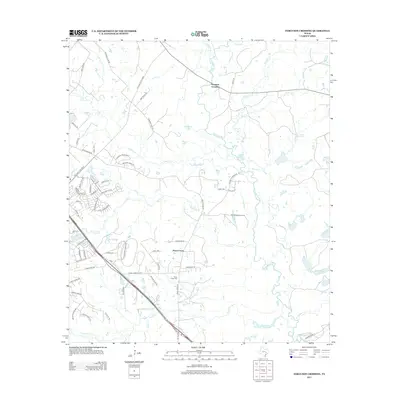
2013 Map of Ferguson Crossing
USGS Topo · Published 2013About this map
The Navasota River meanders through this landscape on the outskirts of College Station, defining the boundary between Brazos and Grimes counties. At its namesake location, Ferguson Crossing marks an important point of connectivity where the river meets the surrounding ranchland and woodland. The 2013 survey captures a mix of longstanding rural features and modern infrastructure, including the massive footprint of the Texas World Speedway near the E Byp. To the south, the settlement of Peach Creek anchors the area near the Peach Creek Cem. The terrain is shaped by numerous watercourses, including Alum Cr, Gibbons Cr, and Panther Cr, which feed into the primary river valley. Notable landmarks such as Carter Lake and Anasazi Bluff Dr provide distinctive points of reference for local historians and land surveyors.
Find a feature on this map
73 named features on this map. Tap any name to fly to it.
Don’t see what you’re looking for? This feature index may not catch every label — zoom into the map to look around manually.
Map Details
Editions of this 2013 Ferguson Crossing Map
This is the sole edition of this map. No revisions or reprints were ever made.
Other maps of this area

1913 · Millican
USGS Topo · 1:31,680

1914 · Gay Hill
USGS Topo · 1:62,500

1914 · Navasota
USGS Topo · 1:62,500

1954 · Austin
USGS Topo · 1:250,000

1956 · Bryan
USGS Topo · 1:62,500

1956 · Carlos
USGS Topo · 1:62,500

1958 · Navasota
USGS Topo · 1:24,000

1959 · Millican
USGS Topo · 1:24,000

1959 · Clay
USGS Topo · 1:24,000

1959 · Reliance
USGS Topo · 1:24,000