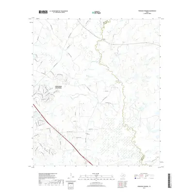
2019 Map of Ferguson Crossing
USGS Topo · Published 2019About this map
The Navasota River meanders along the boundary of Brazos and Grimes counties, defining the southeastern edge of this landscape near College Station. This 2019 survey documents the suburban expansion of the region, where residential developments like those along Harpers Ferry Rd and Mesa Verde Dr meet the remaining rural bottomlands. The map preserves the location of Peach Creek Cem, a point of interest for genealogists tracking local families, situated near the headwaters of Peach Creek. Natural water features such as Tonkaway Lake, Brushy Lake, and the flow of Lick Cr characterize the area's drainage, while the historic name of Ferguson Crossing itself suggests an older point of transit across the river. Small water sources like Sulphur Spring and Lamb Spring are also noted, providing a look at the hydrography that likely supported earlier homesteads before the modern growth of the surrounding college town.
Find a feature on this map
73 named features on this map. Tap any name to fly to it.
Don’t see what you’re looking for? This feature index may not catch every label — zoom into the map to look around manually.
Map Details
Editions of this 2019 Ferguson Crossing Map
This is the sole edition of this map. No revisions or reprints were ever made.
Other maps of this area

1913 · Millican
USGS Topo · 1:31,680

1914 · Gay Hill
USGS Topo · 1:62,500

1914 · Navasota
USGS Topo · 1:62,500

1954 · Austin
USGS Topo · 1:250,000

1956 · Bryan
USGS Topo · 1:62,500

1956 · Carlos
USGS Topo · 1:62,500

1958 · Navasota
USGS Topo · 1:24,000

1959 · Millican
USGS Topo · 1:24,000

1959 · Clay
USGS Topo · 1:24,000

1959 · Reliance
USGS Topo · 1:24,000