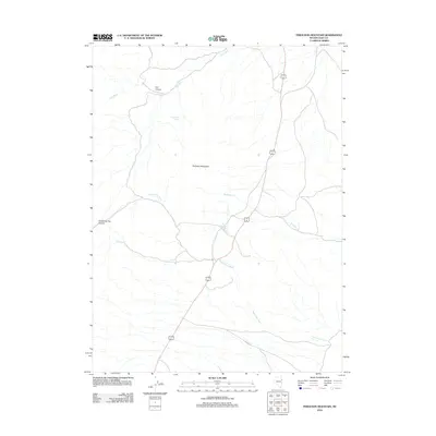
2012 Map of Ferguson Mountain
USGS Topo · Published 2012About this map
Ferguson Springs serves as a central landmark in this high-desert landscape of eastern Nevada. The area is defined by the prominent peak of Ferguson Mountain, with drainage networks like Ferguson Cr and the extensive Dead Cedar Wash carving through the terrain. Human presence is primarily represented by the corridor of Alt 93, which bisects the quadrangle, and the historic track of Ibapah Rd crossing the southeastern corner. This environment is characterized by its vital water sources, including Little Mud Spring and Dead Cedar Spring, which have long been essential nodes for travelers and livestock in the Great Basin. The topography varies from the steep walls of Christmas Tree Canyon and Felt Canyon to the broad alluvial spans of Felt Wash.
Find a feature on this map
11 named features on this map. Tap any name to fly to it.
Don’t see what you’re looking for? This feature index may not catch every label — zoom into the map to look around manually.
Map Details
Editions of this 2012 Ferguson Mountain Map
This is the sole edition of this map. No revisions or reprints were ever made.
Other maps of this area

1955 · Elko
USGS Topo · 1:250,000

1958 · Elko
USGS Topo · 1:250,000

1962 · Elko
USGS Topo · 1:250,000

1965 · Elko
USGS Topo · 1:250,000

1972 · Ferguson Flat
USGS Topo · 1:24,000

1972 · Lion Spring
USGS Topo · 1:24,000

1972 · White Horse Pass
USGS Topo · 1:24,000

1972 · Utah Peak
USGS Topo · 1:24,000

1972 · Ferguson Mtn.
USGS Topo · 1:24,000
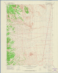
1972 · Spring Gulch
USGS Topo · 1:24,000