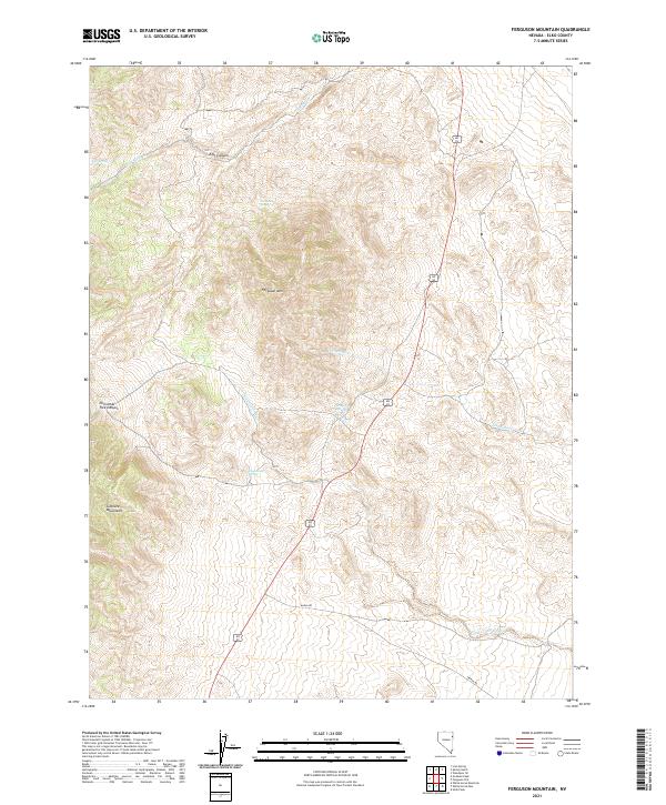
2021 Map of Ferguson Mountain
USGS Topo · Published 2021About this map
Ferguson Mtn dominates the central landscape of this Elko County quadrangle, situated within a high-elevation environment defined by the eastern slopes of the Goshute Mountains. The 2021 survey illustrates a desert terrain where water is the primary geographic driver, marked by numerous named water sources including Ferguson Springs, Felt Spring, and Dead Cedar Spring. These localized springs are vital landmarks in an arid basin-and-range topography where ephemeral drainages like Felt Wash and Dead Cedar Wash carve through the foothills.
Find a feature on this map
17 named features on this map. Tap any name to fly to it.
Don’t see what you’re looking for? This feature index may not catch every label — zoom into the map to look around manually.
Map Details
Editions of this 2021 Ferguson Mountain Map
This is the sole edition of this map. No revisions or reprints were ever made.
Other maps of this area

1955 · Elko
USGS Topo · 1:250,000

1958 · Elko
USGS Topo · 1:250,000

1962 · Elko
USGS Topo · 1:250,000

1965 · Elko
USGS Topo · 1:250,000

1972 · Ferguson Flat
USGS Topo · 1:24,000

1972 · Lion Spring
USGS Topo · 1:24,000

1972 · White Horse Pass
USGS Topo · 1:24,000

1972 · Utah Peak
USGS Topo · 1:24,000

1972 · Ferguson Mtn.
USGS Topo · 1:24,000
1972 · Spring Gulch
USGS Topo · 1:24,000