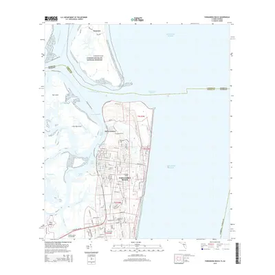
2015 Map of Fernandina Beach
USGS Topo · Published 2015About this map
Fernandina Beach serves as the gateway to this coastal intersection of Florida and Georgia, where the Saint Marys River meets the Atlantic Ocean. The map documents a complex maritime landscape defined by navigable channels like the Intracoastal Waterway and various river segments including Rayonier Reach and City Front Reach. To the north, the protected expanses of the Cumberland Island National Seashore and the historical site of Dungeness sit just across the state line in Georgia. On Amelia Island, the street grid of the modern city contrasts with the older settlement at Old Fernandina and the prominent fortification at Fort Clinch. Local landmarks like McClure Hill and the Bosquebello Cem provide topographical and genealogical points of interest. The area's reliance on water transport is evident through the presence of the Cumberland Sound Fry and the Thomas J Shave, Junior, Bridge connecting the island to the mainland near Piney Island.
Find a feature on this map
71 named features on this map. Tap any name to fly to it.
Don’t see what you’re looking for? This feature index may not catch every label — zoom into the map to look around manually.
Map Details
Editions of this 2015 Fernandina Beach Map
This is the sole edition of this map. No revisions or reprints were ever made.
Other maps of this area

1918 · St Marys
USGS Topo · 1:62,500

1918 · Cumberland Island
USGS Topo · 1:62,500

1918 · Kingsland
USGS Topo · 1:62,500

1919 · Fernandina
USGS Topo · 1:62,500

1919 · St Marys
USGS Topo · 1:62,500

1930 · Cumberland Island
USGS Topo · 1:62,500

1944 · Fernandina
USGS Topo · 1:62,500

1945 · Cumberland Island
USGS Topo · 1:62,500

1948 · Jacksonville
USGS Topo · 1:250,000

1957 · Jacksonville
USGS Topo · 1:250,000