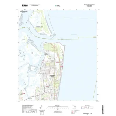
2021 Map of Fernandina Beach
USGS Topo · Published 2021About this map
Amelia Island and Cumberland Island dominate this coastal survey, where the border between Florida and Georgia meets the Atlantic Ocean. The settlement of Fernandina Beach serves as the primary hub, showing a grid of streets that transition into the historic area of Old Fernandina. Near the northern tip of the island, Fort Clinch stands as a sentinel over the Saint Marys Entrance, while across the water, the ruins of Dungeness are preserved within the Cumberland Island National Seashore. The importance of maritime navigation is evident through a complex series of shipping channels, including City Front Reach and the Intracoastal Waterway, which navigate the confluence of the Amelia River and Saint Marys River. In the northernmost reaches, the Naval Submarine Base Kings Bay underscores the strategic military significance of these deep-water sounds.
Find a feature on this map
42 named features on this map. Tap any name to fly to it.
Don’t see what you’re looking for? This feature index may not catch every label — zoom into the map to look around manually.
Map Details
Editions of this 2021 Fernandina Beach Map
This is the sole edition of this map. No revisions or reprints were ever made.
Other maps of this area

1918 · St Marys
USGS Topo · 1:62,500

1918 · Cumberland Island
USGS Topo · 1:62,500

1918 · Kingsland
USGS Topo · 1:62,500

1919 · Fernandina
USGS Topo · 1:62,500

1919 · St Marys
USGS Topo · 1:62,500

1930 · Cumberland Island
USGS Topo · 1:62,500

1944 · Fernandina
USGS Topo · 1:62,500

1945 · Cumberland Island
USGS Topo · 1:62,500

1948 · Jacksonville
USGS Topo · 1:250,000

1957 · Jacksonville
USGS Topo · 1:250,000