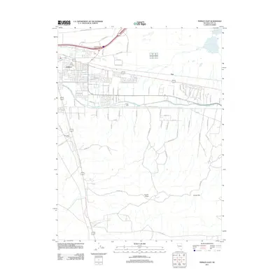
2011 Map of Fernley East
USGS Topo · Published 2011About this map
The Fernley township and the small settlement of Argo anchor this 2011 survey, illustrating a landscape defined by the intersection of desert terrain and significant water engineering. The Truckee Canal and K2B Canal are prominent features, revealing the irrigation infrastructure essential to the region's development. Local transportation history is visible in the alignment of the California Emigrant Trl, which runs alongside modern routes like Truck Inn Way and the East Fernley Interchange. To the south, the topography shifts toward the Virginia Range and Fernley Hills, while the presence of Tiger Field Airport and the Lyon County Complex indicates the area's growth as a hub of civic and aviation activity. Water management remains a central theme in the northeast, marked by Fernley Reservoir Number One and Fernley Reservoir Number Three.
Find a feature on this map
73 named features on this map. Tap any name to fly to it.
Don’t see what you’re looking for? This feature index may not catch every label — zoom into the map to look around manually.
Map Details
Editions of this 2011 Fernley East Map
This is the sole edition of this map. No revisions or reprints were ever made.
Other maps of this area

1890 · Wadsworth
USGS Topo · 1:125,000

1891 · Wabuska
USGS Topo · 1:125,000

1892 · Wadsworth
USGS Topo · 1:125,000

1894 · Wadsworth
USGS Topo · 1:125,000

1894 · Wabuska
USGS Topo · 1:125,000

1957 · Churchill Butte
USGS Topo · 1:62,500

1957 · Two Tips
USGS Topo · 1:62,500

1957 · Wadsworth
USGS Topo · 1:62,500

1957 · Silver Springs
USGS Topo · 1:62,500

1957 · Reno
USGS Topo · 1:250,000