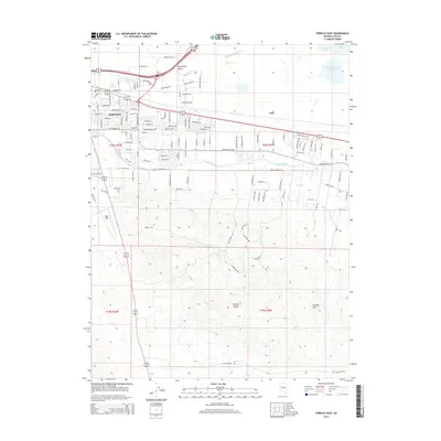
2014 Map of Fernley East
USGS Topo · Published 2014About this map
Fernley anchors this 2014 landscape, marking a point where intensive desert irrigation meets the expansive terrain of the Virginia Range. The town's growth is clearly visible through an intricate grid of residential streets like Mission Way and Salvadore Dr, which push toward the edges of the Fortymile Desert. The area's agricultural and industrial character is defined by water management, with the Truckee Canal and Streiff Drain cutting through the valley to support local operations and the Fernley Reservoir Number One. To the east, the settlement of Argo sits near the reservoirs, while the southern portion of the map is dominated by the high-relief topography of the Fernley Hills. This survey documents a modern Nevada community balancing its residential expansion with its historical reliance on engineered water systems in a challenging arid environment.
Find a feature on this map
61 named features on this map. Tap any name to fly to it.
Don’t see what you’re looking for? This feature index may not catch every label — zoom into the map to look around manually.
Map Details
Editions of this 2014 Fernley East Map
This is the sole edition of this map. No revisions or reprints were ever made.
Other maps of this area

1890 · Wadsworth
USGS Topo · 1:125,000

1891 · Wabuska
USGS Topo · 1:125,000

1892 · Wadsworth
USGS Topo · 1:125,000

1894 · Wadsworth
USGS Topo · 1:125,000

1894 · Wabuska
USGS Topo · 1:125,000

1957 · Churchill Butte
USGS Topo · 1:62,500

1957 · Two Tips
USGS Topo · 1:62,500

1957 · Wadsworth
USGS Topo · 1:62,500

1957 · Silver Springs
USGS Topo · 1:62,500

1957 · Reno
USGS Topo · 1:250,000