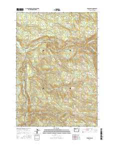
2017 Map of Fernwood
USGS Topo · Published 2017About this map
Glen Avon and Fernwood sit within a landscape defined by the convergence of the Molalla River and its major tributaries in this northern Oregon survey. The river system, including the North Fork Molalla River, Trout Cr, and Pine Cr, dictates the movement of travel and settlement through the valley. Local infrastructure is represented by rural access points like S Haskins Mill Rd and S Dickey Prairie Rd, which hint at the region's historical ties to timber and milling operations. High-elevation access is mapped through routes such as the Molalla Rim Loop and the Huckleberry Trail, providing a detailed look at how the terrain is navigated south of the river forks. Notable water features like Beeres Pond and the drainage of Dead Horse Canyon Cr further illustrate the complex hydrology of the Clackamas County backcountry.
Find a feature on this map
42 named features on this map. Tap any name to fly to it.
Don’t see what you’re looking for? This feature index may not catch every label — zoom into the map to look around manually.
Map Details
Editions of this 2017 Fernwood Map
This is the sole edition of this map. No revisions or reprints were ever made.
Other maps of this area

1916 · Estacada
USGS Topo · 1:125,000

1929 · Mill City
USGS Topo · 1:125,000

1939 · Molalla
USGS Topo · 1:62,500

1940 · Molalla
USGS Topo · 1:62,500

1948 · Vancouver
USGS Topo · 1:250,000

1950 · Vancouver
USGS Topo · 1:250,000

1950 · Vancouver
USGS Topo · 1:250,000

1951 · Lyons
USGS Topo · 1:62,500

1953 · Salem
USGS Topo · 1:250,000

1954 · Salem
USGS Topo · 1:250,000