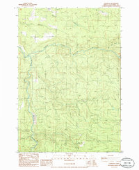
1986 Map of Fernwood
USGS Topo · Published 1986About this map
Fernwood sits at the northern edge of this Clackamas County landscape, where the terrain is heavily defined by the winding course of the Molalla River and its major tributary, the North Fork Molalla River. The 1980s map shows a region dominated by resource extraction and water management, evidenced by numerous Quarry sites and Barrow Pits scattered across the ridgelines. A Gaging Station on the riverbank monitors the flow of these significant waterways as they move through the Cascades foothills.
Find a feature on this map
18 named features on this map. Tap any name to fly to it.
Don’t see what you’re looking for? This feature index may not catch every label — zoom into the map to look around manually.
Map Details
Editions of this 1986 Fernwood Map
This is the sole edition of this map. No revisions or reprints were ever made.
Other maps of this area

1916 · Estacada
USGS Topo · 1:125,000

1929 · Mill City
USGS Topo · 1:125,000

1939 · Molalla
USGS Topo · 1:62,500

1940 · Molalla
USGS Topo · 1:62,500

1948 · Vancouver
USGS Topo · 1:250,000

1950 · Vancouver
USGS Topo · 1:250,000

1950 · Vancouver
USGS Topo · 1:250,000

1951 · Lyons
USGS Topo · 1:62,500

1953 · Salem
USGS Topo · 1:250,000

1954 · Salem
USGS Topo · 1:250,000