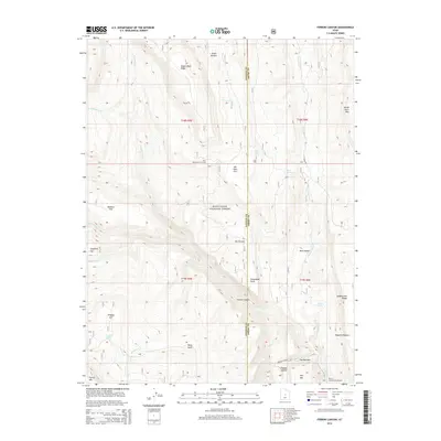
2014 Map of Ferron Canyon
USGS Topo · Published 2014About this map
Wagon Road Ridge and the high plateaus of the Manti-LaSal National Forest dominate this section of the Sanpete and Emery County border. The topography is defined by the deep incision of Ferron Canyon, where the Ferron Canyon Rd follows the winding path of Ferron Cr toward The Narrows. This landscape reflects a history of high-altitude land use, evidenced by the Horn Mountain Cow Camp and numerous named flats like Elk Horn Flat and McEwan Flat. Drainage patterns are intricate, with seasonal and perennial waters such as Black Dragon Cr, Singleton Cr, and the isolated Lizard Lake feeding the larger canyon system. From the heights of North Horn Mtn to the depths of Dugway Hollow, the map illustrates a complex network of ridges and points used for grazing and transit across the Wasatch Plateau.
Find a feature on this map
42 named features on this map. Tap any name to fly to it.
Don’t see what you’re looking for? This feature index may not catch every label — zoom into the map to look around manually.
Map Details
Editions of this 2014 Ferron Canyon Map
This is the sole edition of this map. No revisions or reprints were ever made.
Other maps of this area

1885 · Manti
USGS Topo · 1:250,000

1895 · Manti
USGS Topo · 1:250,000

1922 · Wasatch
USGS Topo · 1:31,680

1923 · Castle Dale
USGS Topo · 1:62,500

1923 · Hiawatha
USGS Topo · 1:62,500

1925 · Castle Dale
USGS Topo · 1:62,500

1925 · Hiawatha
USGS Topo · 1:62,500

1956 · Price
USGS Topo · 1:250,000

1960 · Price
USGS Topo · 1:250,000

1962 · Price
USGS Topo · 1:250,000