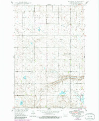
1949 Map of Fessenden SW
USGS Topo · Published 1986About this map
Saint Anna and West Ontario townships define this section of the Missouri River Basin during the late 1940s, a landscape shaped by glacial depressions and prairie water bodies. The terrain is characterized by numerous small lakes and drainages, most notably Cottonwood Lake and the meandering path of Rocky Run which flows through the central portion of the survey. Family history is anchored here by small rural burying grounds, including Dunkard Cem and Byrnjuison Cem, which sit amidst a grid of section roads and occasional landmarks like a lonely Windmill. The proximity of water is a constant theme, with Duck Lake and Lake Ontario filling low-lying basins across the townships of Chaseland and Speedwell. This document provides a look at the rural infrastructure of Wells County before modern agricultural consolidation significantly altered the small-scale field patterns and local landmarks.
Find a feature on this map
14 named features on this map. Tap any name to fly to it.
Don’t see what you’re looking for? This feature index may not catch every label — zoom into the map to look around manually.
Map Details
Editions of this 1949 Fessenden SW Map
2 editions found
Other maps of this area

1945 · Manfred
USGS Topo · 1:62,500

1948 · Fessenden
USGS Topo · 1:62,500

1948 · Manfred
USGS Topo · 1:62,500

1949 · Fessenden SW
USGS Topo · 1:24,000

1949 · Fessenden East
USGS Topo · 1:24,000

1949 · Emrick
USGS Topo · 1:24,000

1949 · Fessenden West
USGS Topo · 1:24,000

1950 · Manfred SE
USGS Topo · 1:24,000

1950 · Manfred
USGS Topo · 1:24,000

1951 · Bowdon
USGS Topo · 1:24,000