
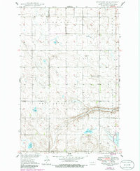
1949 Map of Fessenden SW
USGS Topo · Published 1949About this map
The northern Great Plains landscape of Wells County is documented here during a period of post-war agricultural stability. This 1949 edition focuses on the rural townships of Saint Anna, West Ontario, and Speedwell, where the land is divided into a systematic grid of sections. Local life centers on the Bowman Sch and community burial grounds such as Dunkerd Cem and Byrnjuison Cem. The drainage pattern is defined by the winding course of Rocky Run, which flows toward a cluster of prairie lakes including Duck Lake, Cottonwood Lake, and the local namesake Lake Ontario. A solitary Windmill stands in the northern reaches, a practical necessity for the scattered farmsteads of this era.
Find a feature on this map
17 named features on this map. Tap any name to fly to it.
Don’t see what you’re looking for? This feature index may not catch every label — zoom into the map to look around manually.
Map Details
Editions of this 1949 Fessenden SW Map
2 editions found
Other maps of this area

1945 · Manfred
USGS Topo · 1:62,500

1948 · Fessenden
USGS Topo · 1:62,500

1948 · Manfred
USGS Topo · 1:62,500

1949 · Fessenden East
USGS Topo · 1:24,000

1949 · Emrick
USGS Topo · 1:24,000

1949 · Fessenden West
USGS Topo · 1:24,000

1950 · Manfred SE
USGS Topo · 1:24,000

1950 · Manfred
USGS Topo · 1:24,000

1951 · Bowdon
USGS Topo · 1:24,000

1951 · Heaton
USGS Topo · 1:24,000