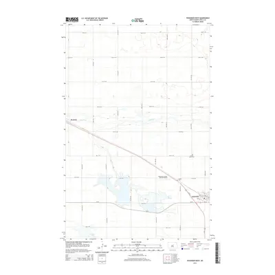
2014 Map of Fessenden West
USGS Topo · Published 2014About this map
Fessenden and the smaller settlement of Manfred anchor this Wells County landscape, where the prairie grid of North Dakota meets the upper reaches of the James River. The town of Fessenden is shown with its local street network, including Railway St N and Railway St S, reflecting the corridor established by Us-52. The importance of community and local heritage is evident in the presence of the Hillside Cem and the German Baptist Cem north of town.
Find a feature on this map
32 named features on this map. Tap any name to fly to it.
Don’t see what you’re looking for? This feature index may not catch every label — zoom into the map to look around manually.
Map Details
Editions of this 2014 Fessenden West Map
This is the sole edition of this map. No revisions or reprints were ever made.
Other maps of this area

1941 · Selz
USGS Topo · 1:62,500

1943 · Maddock
USGS Topo · 1:62,500

1945 · Maddock
USGS Topo · 1:62,500

1945 · Manfred
USGS Topo · 1:62,500

1948 · Fessenden
USGS Topo · 1:62,500

1948 · Manfred
USGS Topo · 1:62,500

1949 · Fessenden SW
USGS Topo · 1:24,000

1949 · Fessenden East
USGS Topo · 1:24,000

1949 · Emrick
USGS Topo · 1:24,000

1949 · Fessenden West
USGS Topo · 1:24,000