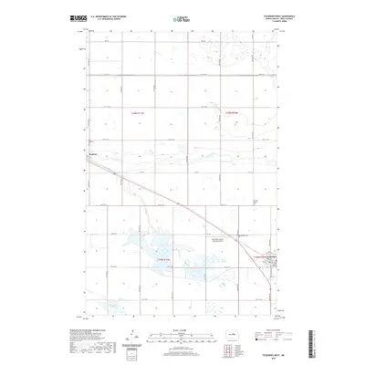
2020 Map of Fessenden West
USGS Topo · Published 2020About this map
The county seat of Fessenden anchors the southeastern corner of this central North Dakota landscape, where the Wells County Courthouse stands as a primary civic landmark. The terrain is defined by the gradual passage of the James River, which meanders through the prairie alongside a network of section-line roads and local thoroughfares like Co RD 5 and Co RD 2. The small settlement of Manfred sits to the west, marking a quiet point on the rail line that bisects the region.
Find a feature on this map
37 named features on this map. Tap any name to fly to it.
Don’t see what you’re looking for? This feature index may not catch every label — zoom into the map to look around manually.
Map Details
Editions of this 2020 Fessenden West Map
This is the sole edition of this map. No revisions or reprints were ever made.
Other maps of this area

1941 · Selz
USGS Topo · 1:62,500

1943 · Maddock
USGS Topo · 1:62,500

1945 · Maddock
USGS Topo · 1:62,500

1945 · Manfred
USGS Topo · 1:62,500

1948 · Fessenden
USGS Topo · 1:62,500

1948 · Manfred
USGS Topo · 1:62,500

1949 · Fessenden SW
USGS Topo · 1:24,000

1949 · Fessenden East
USGS Topo · 1:24,000

1949 · Emrick
USGS Topo · 1:24,000

1949 · Fessenden West
USGS Topo · 1:24,000