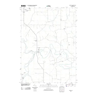
2010 Map of Festina
USGS Topo · Published 2010About this map
Turkey River and the Little Turkey River wind through this landscape of the 2010s, where small settlements like Festina and Eldorado anchor a grid of rural roads. The area is notable for its concentration of burial grounds, including the Smallest Church Cemetery and Saint Marys Cemetery near the northern border, and the Auburn Township Cemetery Township Cemetery further south. These sites, along with the Stavarger Cemetery and Bethany Cemetery, indicate a well-preserved record of the region's early community centers. The rural infrastructure is defined by crossings such as the Eldorado Bridge and the W42 Bridge over the Turkey River, while the Festina Post Office remains a central landmark. The terrain is further characterized by the drainage of Dry Branch and Nutting Creek, which carve through the agricultural uplands surrounding Twin Springs and Douglass.
Find a feature on this map
59 named features on this map. Tap any name to fly to it.
Don’t see what you’re looking for? This feature index may not catch every label — zoom into the map to look around manually.
Map Details
Editions of this 2010 Festina Map
This is the sole edition of this map. No revisions or reprints were ever made.
Other maps of this area

1901 · Oelwein
USGS Topo · 1:125,000

1906 · Decorah
USGS Topo · 1:125,000

1958 · La Crosse
USGS Topo · 1:250,000

1959 · Dubuque
USGS Topo · 1:250,000

1961 · Dubuque
USGS Topo · 1:250,000

1961 · La Crosse
USGS Topo · 1:250,000

1962 · Dubuque
USGS Topo · 1:250,000

1965 · La Crosse
USGS Topo · 1:250,000

1965 · Elgin
USGS Topo · 1:24,000

1975 · Decorah 4 NW
USGS Topo · 1:24,000