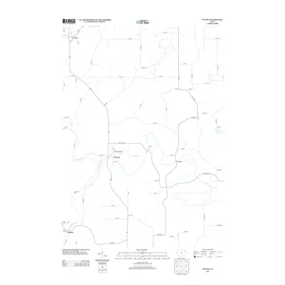
2013 Map of Festina
USGS Topo · Published 2013About this map
Turkey River and its tributary, the Little Turkey River, define the landscape of this Fayette County region, where agricultural plateaus are segmented by a network of winding waterways. The small settlement of Eldorado sits at a critical junction near the Eldorado Bridge, serving as a focal point for the surrounding rural road network. To the north, the community of Festina anchors the map near the banks of Brockamp Cr. The geography is characterized by numerous small drainage features like Dry Br and Nutting Cr, which have historically dictated the placement of homesteads and connecting routes. The mapping of the W42 Bridge and various county roads, including Co Hwy W42 and Lion Rd, illustrates the modern infrastructure used to navigate the varied terrain of the Douglass area.
Find a feature on this map
65 named features on this map. Tap any name to fly to it.
Don’t see what you’re looking for? This feature index may not catch every label — zoom into the map to look around manually.
Map Details
Editions of this 2013 Festina Map
This is the sole edition of this map. No revisions or reprints were ever made.
Other maps of this area

1901 · Oelwein
USGS Topo · 1:125,000

1906 · Decorah
USGS Topo · 1:125,000

1958 · La Crosse
USGS Topo · 1:250,000

1959 · Dubuque
USGS Topo · 1:250,000

1961 · Dubuque
USGS Topo · 1:250,000

1961 · La Crosse
USGS Topo · 1:250,000

1962 · Dubuque
USGS Topo · 1:250,000

1965 · La Crosse
USGS Topo · 1:250,000

1965 · Elgin
USGS Topo · 1:24,000

1975 · Decorah 4 NW
USGS Topo · 1:24,000