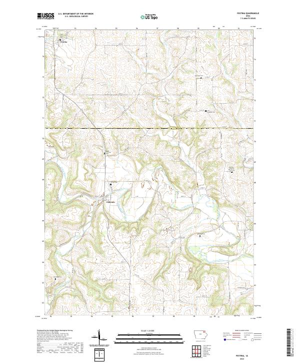
2022 Map of Festina
USGS Topo · Published 2022About this map
Turkey River and the Little Turkey River define the winding drainage patterns of this section of the Iowa landscape. The settlement of Eldorado sits near the riverbanks, while Festina occupies the northwest corner of the survey. The region is notable for its high density of local cemeteries, which often served specific congregations or rural townships. These include Saint Marys Cem and Stavanger Cem, as well as the First Lutheran Cem. The land is divided by a strict grid of rural roads, such as Nickel Rd and 290th St, which cross the county line between Winneshiek and Fayette counties. Smaller watercourses like Brockamp Cr and Nutting Cr feed into the larger river system, supporting the agricultural character of the area.
Find a feature on this map
43 named features on this map. Tap any name to fly to it.
Don’t see what you’re looking for? This feature index may not catch every label — zoom into the map to look around manually.
Map Details
Editions of this 2022 Festina Map
This is the sole edition of this map. No revisions or reprints were ever made.
Other maps of this area

1901 · Oelwein
USGS Topo · 1:125,000

1906 · Decorah
USGS Topo · 1:125,000

1958 · La Crosse
USGS Topo · 1:250,000

1959 · Dubuque
USGS Topo · 1:250,000

1961 · Dubuque
USGS Topo · 1:250,000

1961 · La Crosse
USGS Topo · 1:250,000

1962 · Dubuque
USGS Topo · 1:250,000

1965 · La Crosse
USGS Topo · 1:250,000

1965 · Elgin
USGS Topo · 1:24,000

1975 · Decorah 4 NW
USGS Topo · 1:24,000