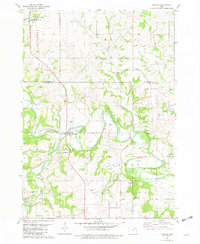
1981 Map of Festina
USGS Topo · Published 1982About this map
The Turkey River meanders across the border of Winneshiek and Fayette counties, shaping a landscape defined by narrow valley floors and deeply incised drainage systems like Nutting Creek and Dry Branch. This late-twentieth-century survey documents a traditional Northeast Iowa agricultural mosaic where rural life centers on religious and educational foundations such as St Marys Sch in Festina and the First Lutheran Ch to the east.
Find a feature on this map
38 named features on this map. Tap any name to fly to it.
Don’t see what you’re looking for? This feature index may not catch every label — zoom into the map to look around manually.
Map Details
Editions of this 1981 Festina Map
This is the sole edition of this map. No revisions or reprints were ever made.
Other maps of this area

1901 · Oelwein
USGS Topo · 1:125,000

1906 · Decorah
USGS Topo · 1:125,000

1958 · La Crosse
USGS Topo · 1:250,000

1959 · Dubuque
USGS Topo · 1:250,000

1961 · Dubuque
USGS Topo · 1:250,000

1961 · La Crosse
USGS Topo · 1:250,000

1962 · Dubuque
USGS Topo · 1:250,000

1965 · La Crosse
USGS Topo · 1:250,000

1965 · Elgin
USGS Topo · 1:24,000

1975 · Decorah 4 NW
USGS Topo · 1:24,000