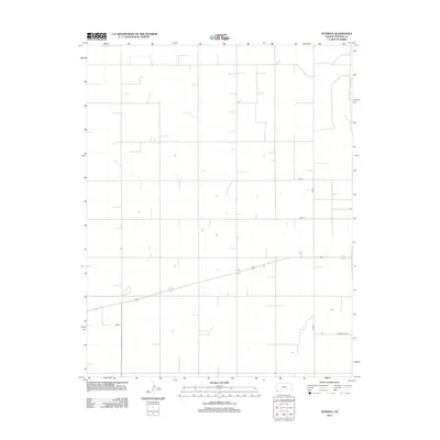
2012 Map of Feterita
USGS Topo · Published 2012About this map
Feterita stands as a focal point in this portion of Stevens County, situated within a vast grid of agricultural section lines and rural thoroughfares. The landscape is defined by its rectilinear organization, where long-distance routes like Road Q and Road P provide essential connectivity through the high plains. In the southern portion of the quadrangle, S Washington St and Road 10 intersect near the small settlement, illustrating the persistent pattern of rural life and land management in this part of Kansas. This 2012 survey captures the region's sparse development, reflecting a community centered around the infrastructure of the surrounding farmland and the arterial roads that tie the prairie together.
Find a feature on this map
5 named features on this map. Tap any name to fly to it.
Don’t see what you’re looking for? This feature index may not catch every label — zoom into the map to look around manually.
Map Details
Editions of this 2012 Feterita Map
This is the sole edition of this map. No revisions or reprints were ever made.
Other maps of this area

1955 · Dodge City
USGS Topo · 1:250,000

1958 · Dodge City
USGS Topo · 1:250,000

1959 · Dodge City
USGS Topo · 1:250,000

1973 · Rolla NE
USGS Topo · 1:24,000
1974 · Rolla SE
USGS Topo · 1:24,000
1974 · Hugoton SE
USGS Topo · 1:24,000

1974 · Hugoton
USGS Topo · 1:24,000

1974 · Feterita
USGS Topo · 1:24,000
1974 · Hugoton SW
USGS Topo · 1:24,000

1974 · Shore Airport SE
USGS Topo · 1:24,000