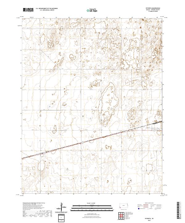
2022 Map of Feterita
USGS Topo · Published 2022About this map
The High Plains of Stevens County are defined by a rhythmic grid of agricultural access roads and sprawling township sections. This 2022 survey captures the landscape of t33s r37w and surrounding townships, where the human footprint is primarily marked by a vast network of numbered and lettered thoroughfares. From Rd T in the north to Rd K at the southern edge, these routes facilitate the industrial-scale farming operations characteristic of Southwest Kansas. Occasional residential or operational clusters appear near the intersection of 10th St and Baker Ave, providing small points of density in an otherwise open expanse. The survey illustrates how modern land management follows the historical Public Land Survey System, with roads like Rd 11 and Rd 7 tracing the section lines that have governed this territory for generations.
Find a feature on this map
21 named features on this map. Tap any name to fly to it.
Don’t see what you’re looking for? This feature index may not catch every label — zoom into the map to look around manually.
Map Details
Editions of this 2022 Feterita Map
This is the sole edition of this map. No revisions or reprints were ever made.
Other maps of this area

1955 · Dodge City
USGS Topo · 1:250,000

1958 · Dodge City
USGS Topo · 1:250,000

1959 · Dodge City
USGS Topo · 1:250,000

1973 · Rolla NE
USGS Topo · 1:24,000
1974 · Rolla SE
USGS Topo · 1:24,000
1974 · Hugoton SE
USGS Topo · 1:24,000

1974 · Hugoton
USGS Topo · 1:24,000

1974 · Feterita
USGS Topo · 1:24,000
1974 · Hugoton SW
USGS Topo · 1:24,000

1974 · Shore Airport SE
USGS Topo · 1:24,000