
1971 Map of Fickling Mill
USGS Topo · Published 1973About this map
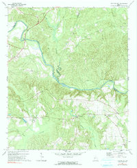
Fickling Mill sits at the junction of several rural roads in this early 1970s survey, marking a localized hub within a landscape defined by the winding course of the Flint River. The waterway serves as a natural boundary between Upson, Taylor, and Crawford Counties, joined by significant tributaries like Auchumpkee Creek and Patsiliga Creek. This era of the Georgia Piedmont is captured through its dense network of rural spiritual and community centers, with several congregations such as Olive Grove Ch and Damascus Ch dotting the terrain. The presence of numerous small family or community burial grounds, including the Harris Cem and Midway Cem, provides essential points of reference for genealogists. To the south, Lake Mary and a nearby Campground suggest the area's transition into recreational use during this period, while a Lookout Tower stands as a sentinel over the heavily wooded creek bottoms.
Find a feature on this map
31 named features on this map. Tap any name to fly to it.
Don’t see what you’re looking for? This feature index may not catch every label — zoom into the map to look around manually.
Map Details
Editions of this 1971 Fickling Mill Map
2 editions found
Other maps of this area

1935 · Thomaston
USGS Topo · 1:48,000

1939 · Thomaston
USGS Topo · 1:62,500

1951 · Yatesville
USGS Topo · 1:62,500

1955 · Phenix City
USGS Topo · 1:250,000

1957 · Phenix City
USGS Topo · 1:250,000

1958 · Phenix City
USGS Topo · 1:250,000

1971 · Prattsburg
USGS Topo · 1:24,000
1971 · Lincoln Park
USGS Topo · 1:24,000

1971 · Reynolds
USGS Topo · 1:24,000
1971 · Roberta
USGS Topo · 1:24,000