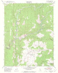
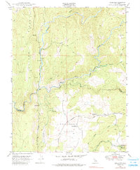
1949 Map of Fiddletown
USGS Topo · Published 1980About this map
The confluence of the North Fork Cosumnes River, Middle Fork Cosumnes River, and South Fork Cosumnes River defines the rugged geography of this Amador and El Dorado County borderland. At the time of this 1949 field check, the landscape retains its Gold Rush era imprint, characterized by deep river canyons and prominent topographic features like Logtown Ridge. In the southern portion of the map, the Shenandoah Valley reveals a more settled agricultural pattern, centered around the Shenandoah Road corridor.
Find a feature on this map
29 named features on this map. Tap any name to fly to it.
Don’t see what you’re looking for? This feature index may not catch every label — zoom into the map to look around manually.
Map Details
Editions of this 1949 Fiddletown Map
5 editions found
Other maps of this area

1889 · Jackson
USGS Topo · 1:125,000

1891 · Placerville
USGS Topo · 1:125,000

1892 · Jackson
USGS Topo · 1:125,000

1892 · Placerville
USGS Topo · 1:125,000

1893 · Placerville
USGS Topo · 1:125,000

1897 · Jackson
USGS Topo · 1:125,000

1902 · Jackson
USGS Topo · 1:125,000

1941 · Sutter Creek
USGS Topo · 1:62,500

1944 · Sutter Creek
USGS Topo · 1:62,500

1947 · Sacramento
USGS Topo · 1:250,000