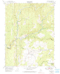
1949 Map of Fiddletown
USGS Topo · Published 1986About this map
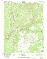
The Cosumnes River and its complex fork system dominate this mid-century landscape on the border of Amador and El Dorado counties. The map details a transition from the elevated Logtown Ridge in the west down toward the agricultural Shenandoah Valley, where the local community was anchored by the Shenandoah Sch and nearby Shenandoah Cem. Mining history is evident at the Briarcliff Mines, while water management for the region is traced through the Plymouth Ditch winding across the terrain. Small settlements and points of interest such as Nashville, Enterprise, and Bell Ranch appear alongside the larger community of Fiddletown in the southeast corner. The network of canyons and gulches, including Grizzly Creek and Spanish Creek, highlights the difficult topography that shaped the development of early roads and water systems in this section of the Gold Country foothills.
Find a feature on this map
31 named features on this map. Tap any name to fly to it.
Don’t see what you’re looking for? This feature index may not catch every label — zoom into the map to look around manually.
Map Details
Editions of this 1949 Fiddletown Map
5 editions found
Other maps of this area

1889 · Jackson
USGS Topo · 1:125,000

1891 · Placerville
USGS Topo · 1:125,000

1892 · Jackson
USGS Topo · 1:125,000

1892 · Placerville
USGS Topo · 1:125,000

1893 · Placerville
USGS Topo · 1:125,000

1897 · Jackson
USGS Topo · 1:125,000

1902 · Jackson
USGS Topo · 1:125,000

1941 · Sutter Creek
USGS Topo · 1:62,500

1944 · Sutter Creek
USGS Topo · 1:62,500

1947 · Sacramento
USGS Topo · 1:250,000