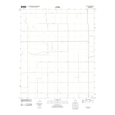
2010 Map of Field SW
USGS Topo · Published 2010About this map
Alamosa Creek winds through the northern reaches of this high plains landscape, defining the topography of an area dominated by the expansive grid of rural route planning. Situated along the jurisdictional boundaries of Curry, Quay, and Roosevelt counties, the territory is segmented by a precise network of arterial paths such as County Line Rd, N Roosevelt Road 23, and Curry Road 25. This 2010 survey illustrates the modern agricultural and ranching layout of eastern New Mexico, where the vast open range is managed through systematic road numbering. In the southeast corner, the isolated Brooks Lake serves as a distinct hydrological marker in an otherwise arid expanse, highlighting the importance of seasonal water features in this portion of the Llano Estacado.
Find a feature on this map
36 named features on this map. Tap any name to fly to it.
Don’t see what you’re looking for? This feature index may not catch every label — zoom into the map to look around manually.
Map Details
Editions of this 2010 Field SW Map
This is the sole edition of this map. No revisions or reprints were ever made.
Other maps of this area

1954 · Clovis
USGS Topo · 1:250,000

1957 · Melrose
USGS Topo · 1:62,500

1958 · Clovis
USGS Topo · 1:250,000

1972 · Melrose East
USGS Topo · 1:24,000

1973 · Weber City
USGS Topo · 1:24,000

1973 · Krider
USGS Topo · 1:24,000

1973 · Field SE
USGS Topo · 1:24,000

1973 · Melrose West
USGS Topo · 1:24,000

1973 · Mc Alister
USGS Topo · 1:24,000

1973 · Field SW
USGS Topo · 1:24,000