
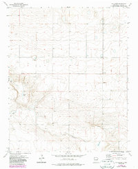
1973 Map of Mc Alister
USGS Topo · Published 1975About this map
The small settlement of McAlister anchors this eastern New Mexico survey, providing a record of the community and its outlying landscape in the early 1970s. Located in Quay County, the area is defined by its agricultural and ranching water sources, represented by several named Wells and the intermittent flow of Alamosa Creek winding through the southern half of the quadrangle. For genealogists and local historians, the McAlister Cem remains a critical landmark for tracing family roots in this corner of the High Plains. The landscape is also dotted with evidence of land management and resource extraction, including a Drill Hole and multiple Gravel Pits, alongside depressions that form seasonal water bodies like Caballo Lake and Burk Lake.
Find a feature on this map
10 named features on this map. Tap any name to fly to it.
Don’t see what you’re looking for? This feature index may not catch every label — zoom into the map to look around manually.
Map Details
Editions of this 1973 Mc Alister Map
2 editions found
Other maps of this area

1954 · Clovis
USGS Topo · 1:250,000

1958 · Clovis
USGS Topo · 1:250,000

1970 · Jordan
USGS Topo · 1:24,000
1970 · Cunavea Basin
USGS Topo · 1:24,000

1971 · Ragland
USGS Topo · 1:24,000

1973 · Weber City
USGS Topo · 1:24,000

1973 · House
USGS Topo · 1:24,000
1973 · Peach Canyon
USGS Topo · 1:24,000

1973 · Field SW
USGS Topo · 1:24,000
1973 · House SE
USGS Topo · 1:24,000